Prior to arriving:
Check Trailforks to see if we’re open. We make a large effort to stay open with the exception of unusually wet conditions so please heed all closures. For more details, find weekly condition updates in our FB group. Once or twice a year we may close for large events but try to coexist with several smaller events throughout the summer. Assume scant to no cell service in the parking areas and no signal whatsoever on the trails. So, for safety’s sake, try to ride with at least one other person. If going it alone, let someone else know your itinerary and ride within your ability. It might be a while until someone can find you if you’re incapacitated. Hone up on not just your route but the entire trail system. In an emergency situation, a rule of thumb is that cell service usually improves in proximity to VT 100. To get the most out of the trails, plan on spending an average of three hours riding as well as climbing and descending over a thousand feet. Plan your water and nutrition needs accordingly. At the request of the land manager, leave your pups at home. Class one ebikes are allowed. GMT doesn’t consider itself a free trail system. We run on the stewardship economy. It thrives or deteriorates based on the collective decision making of those who use it. Your choices either contribute to, have a neutral effect or slowly bankrupt the trails. But we’re not necessarily asking for grand gestures, just simple, and often small, acts of conscientiousness that demonstrate your care. Why not bring (as some of you already do): a few extra bucks to throw in the donation box, a small folding saw or a pair of clippers in your pack to take a second to clear an annoying branch or a striped maple that keels over at the slightest provocation? Many blowdowns can be dispatched by a couple riding buddies and creative use of gravity. But if you encounter a larger problem that cannot be solved in a minute or two, please let us know. You’re Here! Find the best place to park. The most foolproof trailhead is at 1199 Tweed River Drive (Fiona’s Trailhead next to Green Trail). The final leg of road leading there is a little rough depending on the last time it was graded, but doesn’t require 4wd or a high clearance vehicle. Amee Farm was the original start of the trails and carries a lot of nostalgia, but since the floodwaters of Tropical Storm Irene took out the bridge across Tweed River it’s been problematic. Once you ride out of the woods and across the haying fields, you are off Amee property and crossing private land owned by a multigenerational farming family named Fuster (sound familiar?) Please respect their wishes and cross the river at this point to Stairs/Escalator Trail instead of following the VAST along the river. The river averages knee depth and yes your feet will get wet and the water is cold. (But the good news is that there are other parking options.) Don’t attempt to cross after storms for obvious reasons. Keep in mind that the Fusters are under no obligation to keep their land open to the public and will justifiably close access if their wishes are not respected and choose your course of action wisely. Riverside Farm parking in the field next to the white barn is also allowed on weekdays and on weekends when there are no weddings or other special events. Weddings will typically take place Friday through Sunday and there will be signage directing you to alternative parking. It is imperative that you heed that signage. The weddings are exclusive events that support the property on which the majority of the trails exist. It should go without saying not to bike through them. Other parking: Parking in designated spaces at the town green, at the river park by the bridge and at the yoga studio on Lower Michigan is also permitted. Parking along VT 100 or Tweed River Drive is STRICTLY PROHIBITED. Closest LBS’s are, to the south, Alpine Bike Works and Base Camp in Killington and, to the north, Green Mountain Bikes in Rochester. Along the Way: Not sure which way to go? The old standby GMT loop rarely disappoints and still provides a representative sampling of the terrain, plenty of enjoyment and just enough challenge for the casual rider. But when you’re ready to go next level, there are lots of fun and sometimes demanding options to keep riders of all stripes intrigued. The Yonderers, Bubba Lubbas, and seekers of trails that are being kept off the map for good reason are starting to outnumber the daytrippers. Whichever way you go, just about everyone ends up at Shrek’s Stone Hut and overlook. It has some of the most prodigious views of the Green Mountain ridgeline anywhere and it’s also managed to remain a fairly well kept secret. Keep in mind that there will be guests staying at the hut every weekend and on many weekdays as well. Insofar as their stay supports stewardship on the trails, they’re actually your guests too. Be welcoming and gracious hosts. Many guests report back that the great people they meet passing through is a highlight of their stay. (If you would like to stay, I suggest you book as early as possible.) Paper wasps inhabit the eaves of the hut. They’re generally docile but don’t provoke them. Each year, there are always several bear families that live on the trail system. Encounters are a real possibility any time of the season, but especially numerous early on (May and June) and during prime berry season (late July to early September). Bear bells are a useful precaution, but most people make enough noise while riding that the bears have scattered long before riders even see them. If you do see one, the best strategy may be to do nothing but make your presence known. Most bears are intelligent enough to know that humans are nothing but bad news and will run as fast as they can away from you. The GMT is designated multiuse and though you may encounter people on foot anywhere on the trails, this is especially true on Green Trail (easiest access to the top) and anywhere the trail intersects with the stone staircase running from bottom to top (Noodles, Rabbit Hole, Stonewall, Wrong Way, Devil’s Throat, Mountaintop Loop). Trail etiquette rules apply. All trail users are welcome. Après: Stay for a while, relax, pop open a cold one, have a picnic, share stories, grab lunch by the town green….But...pack out all garbage. No fires on the property. No camping or overnight parking without permission. Please note any blowdowns encountered along the way on the white boards at Amee or Green Trail trailheads (you can also message us on FB, IG or through email or in person if you see us out there.) . We will saw them out of the way asap, but GMT is an extensive trail system with a skeleton crew of regular stewards so don’t assume we already know about them. Drop a few bucks in the donation box or consider a ROC VMBA membership if you ride here on a regular basis (5x or so a season). Have a passion for dirt? We’re always looking for dedicated stewards. (But we do fine with a system of rolling stewardship. It’s rare that we’ll have organized trail days in the evenings or on weekends.) Want to use your creativity to give back? We’re open to unconventional ways of expressing your appreciation for the trails. Inspired? Just ask. |
Welcome to GMT!
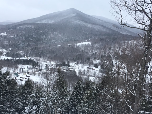
Gnarly Adventures The Green Mountain Trails are a multiuse network of flowy singletrack over varied terrain in Pittsfield and Stockbridge, Vermont eight miles North of Killington. Mountain bike, trail run, hike, snow shoe on some 25 mi. of stellar trails. We are a ROC affiliated trail system. To support our trails, join or renew today. Visiting? Here's how to upcycle your experience! We have trails for all abilities, passing by mountain streams and overlooks, with a beguiling panorama of The Green Mountains and pastoral valley at the summit that can't be missed. There is a thousand feet of climbing and descending. Though a majority of the trails are relatively smooth and flowy, there are several miles of rooty, rocky, technical singletrack. Over 100 bermed switchbacks make the long descents a blast for mountain bikers. Most of the uphills are gradual and forgiving on the quads, but challenging uphills are also an option. Depending on your route, descents can linger for as long as six miles. The entire trail system is open to the public, but we appreciate your membership! |


